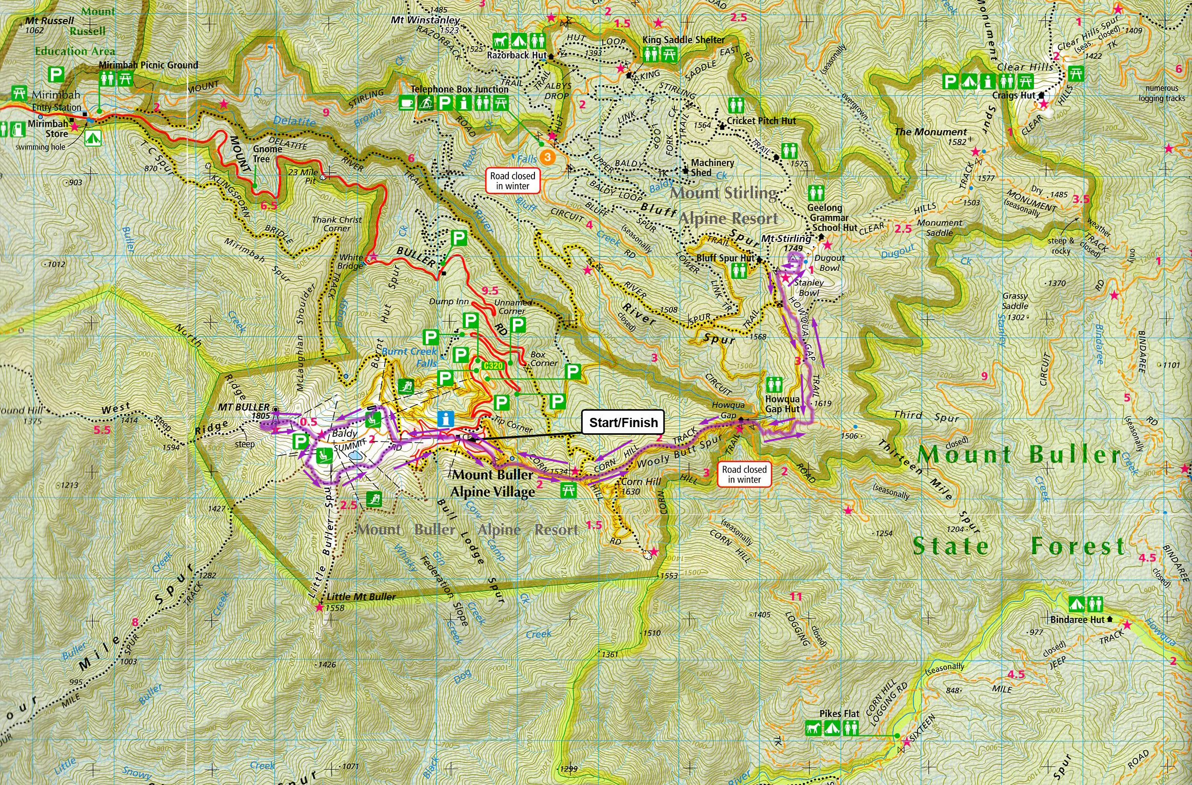
Course Details
Mt Buller Village – Mt Stirling – Mt Buller Summit – Mt Buller Village
This run commences at the Village clock tower.
Stage 1
Mt Buller Village—Howqua Gap—4.6 km
- At the Village square, follow the marked course to the Circuit Road.
- Cross the Circuit Road and pick up the trail signposted “7” and follow this to a track junction.
- Follow the track marked “Stirling via Corn Hill” (a 4WD track).
- Follow the Corn Hill fire trail (do not go to the summit) before dropping down to Howqua Gap.
Caution—be aware of downhill mountain bikers on this trail.
Stage 2
Howqua Gap—Mt Stirling—4.0 km
- Cross the Circuit Rd and take the foot path up to Howqua Gap Hut (toilet/water).
- Follow the Howqua Gap track past Maps 47, 48, 45 and 40 up to Stanley’s Bowl and then onto the summit of Mt Stirling (1749 m).
- Great views! Water and toilets are available 100 m away at the GGS Hut.
Caution—be aware of 4WDs on the track.
Stage 3
Mt Stirling—Mt Buller Summit—Village—12.6 km
- From Mt Stirling retrace your route back to the Village clock tower and head up to the summit via the Nature Walk trail.
- Back at the Summit Car Park turn right onto the Nature Trail and return to the finish in the Village Square.
- Relax and take in the scenery over a cool drink and cake or coffee.
Course Profile

To download the JPEG file, click here.
Map

Map, elevation profile and Strava activity by courtesy of Aaron Knight https://www.strava.com/activities/275685631
To download the pdf, click here.