The following three maps cover the course for 42/60/100/160 km distances. Please note, the GPX files on the course pages are not meant to be uploaded into Avenza, but onto your watch (or phone if you want to follow the course in Strava or other apps).
Map 1
This is the map everyone will need. Feel free to download and print it for the event.
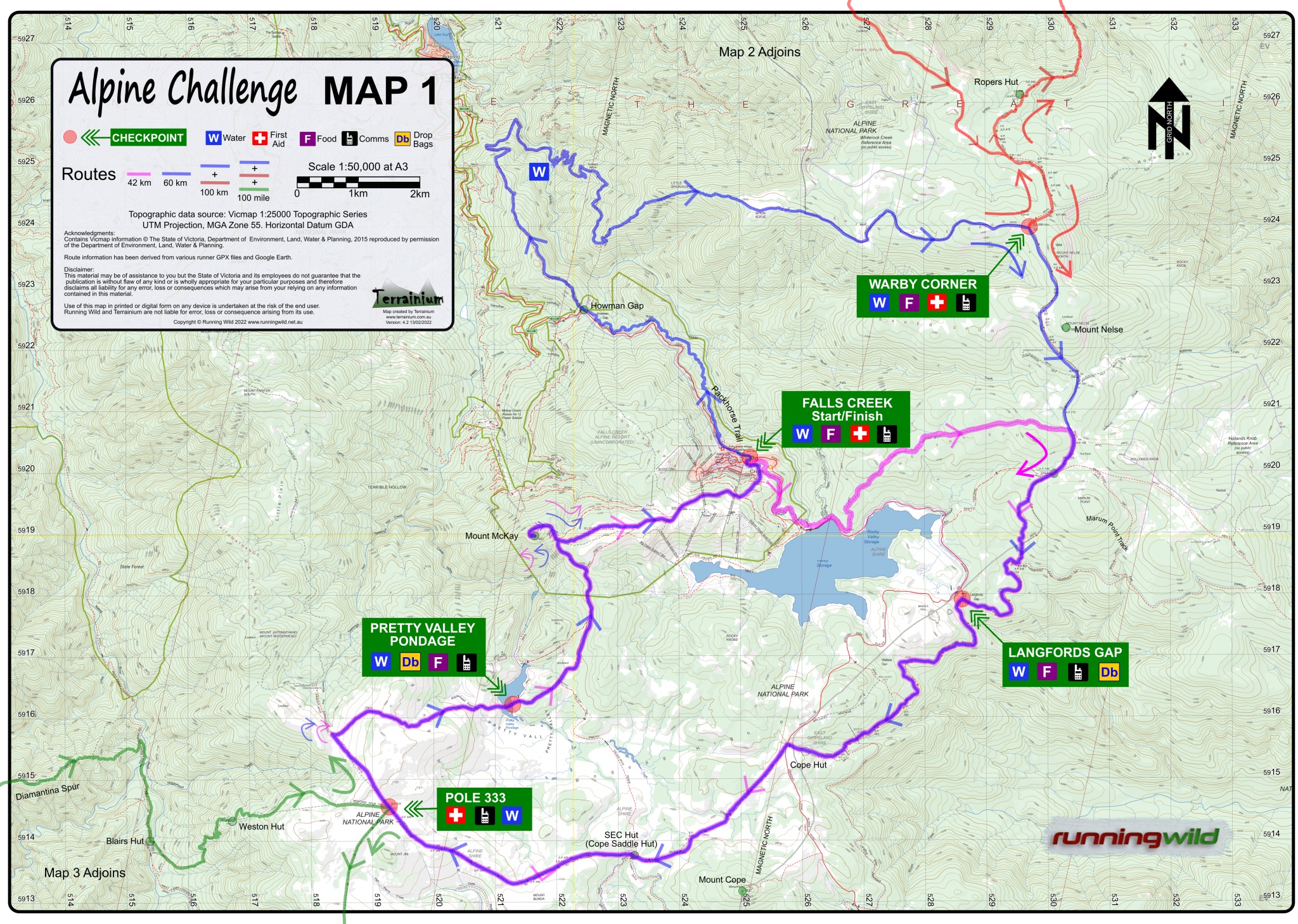
You can download the printable pdf map from here.
Map 2
The 100 km and 100 miles runners will need this map.
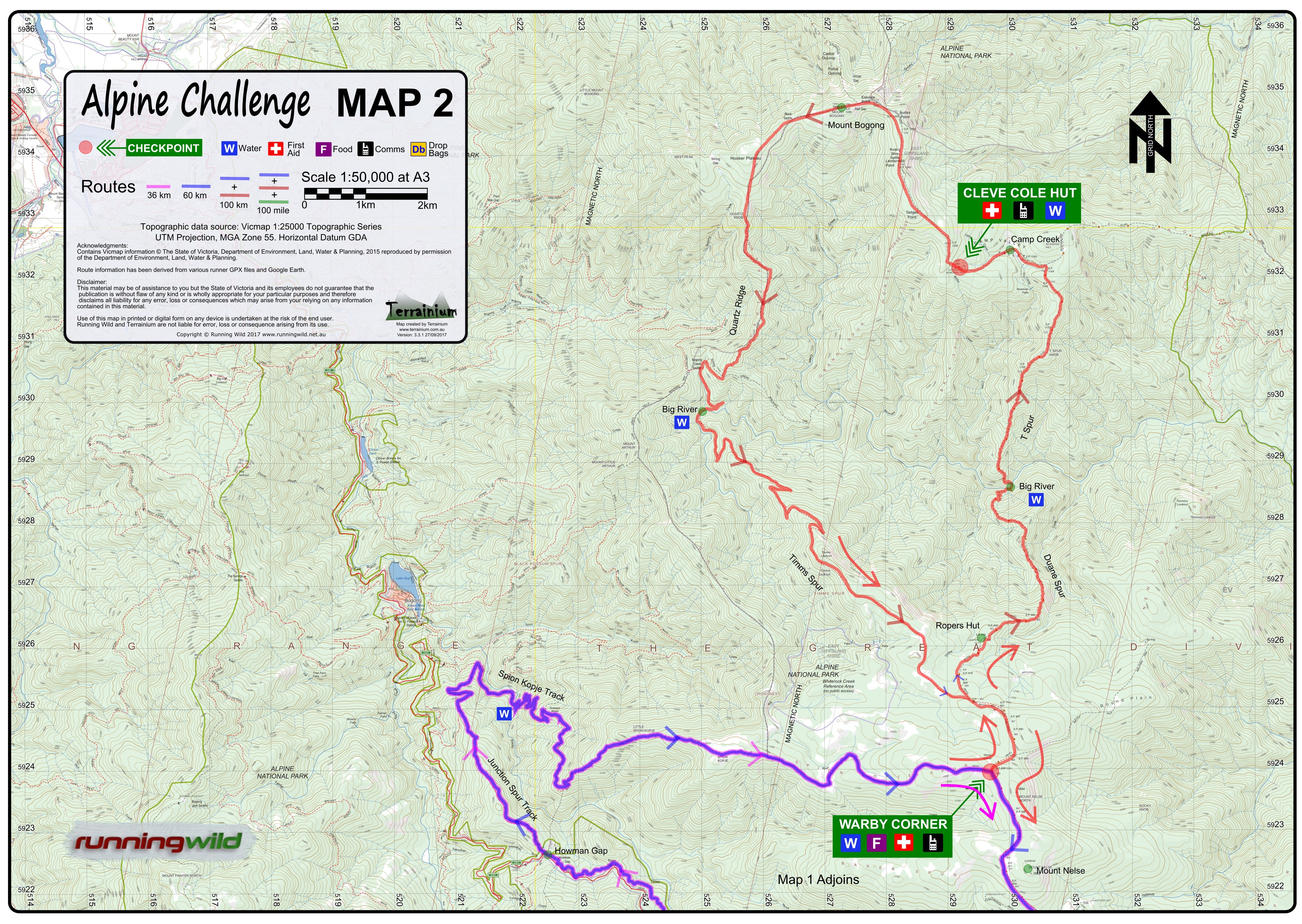
You can download the printable pdf map from here (4.7 MB).
Map 3
The 100 miles runners will need this map.
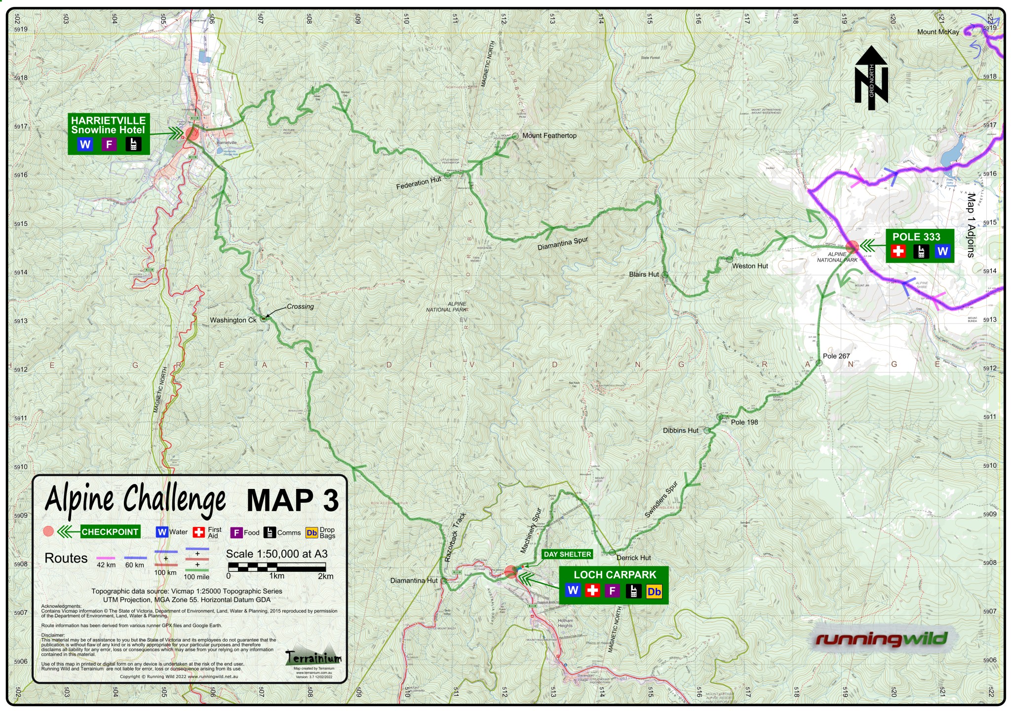
You can download the printable pdf map from here.
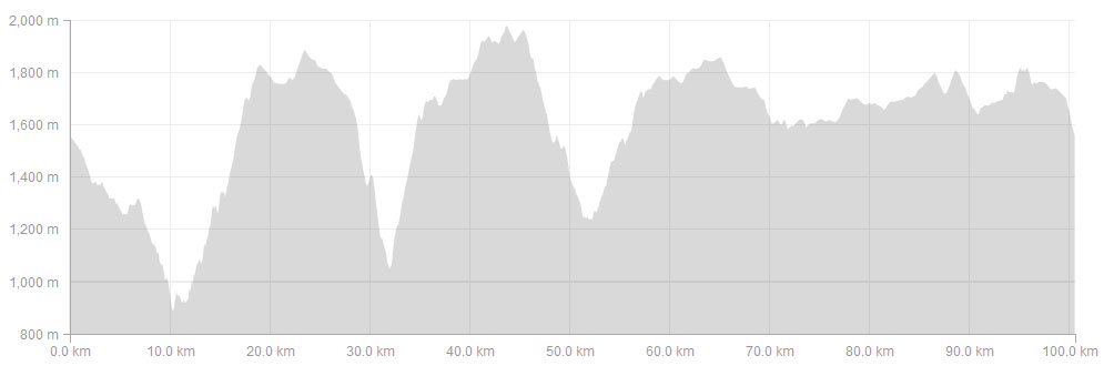
100 mile Elevation Profile
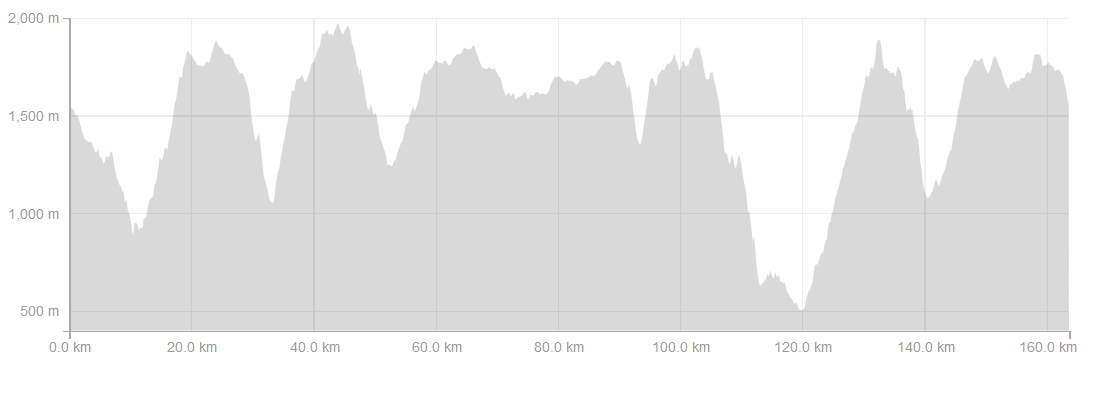
The 100 mile course Strava activity is available by courtesy of Chris Roberts and can be downloaded here and the GPX here.
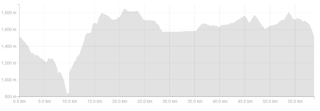
100 km Elevation Profile
The 100 km Strava course is available by courtesy of Dylan Dwyer and can be viewed here and the GPX file here.
60 km Elevation Profile
The 60 km course Strava activity is available by courtesy of Daniel Nunan and can be downloaded here and the GPX here.
You can download the GPX files for the 10 km course, the 16 km course, 25 km course and the 42 km course.
To download your free Avenza Map of all the Alpine Challenge courses click on the link below and follow the instructions
https://www.terrainium.com.au/blog/alpine-challenge-2022/